MAPS OF SHALE GAS LEASES, QUEBEC
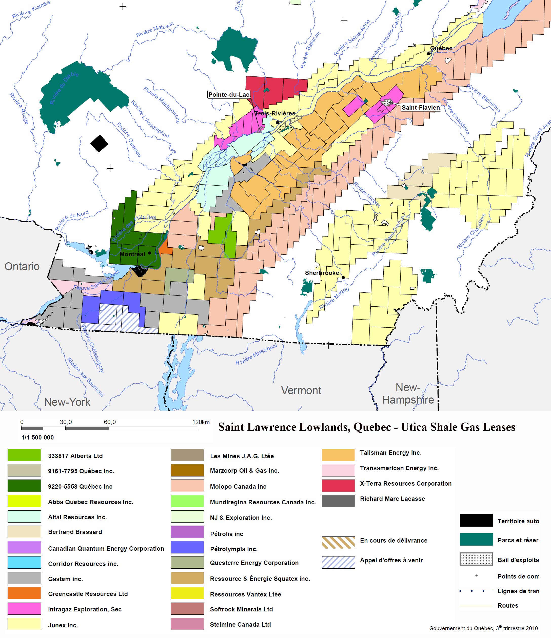
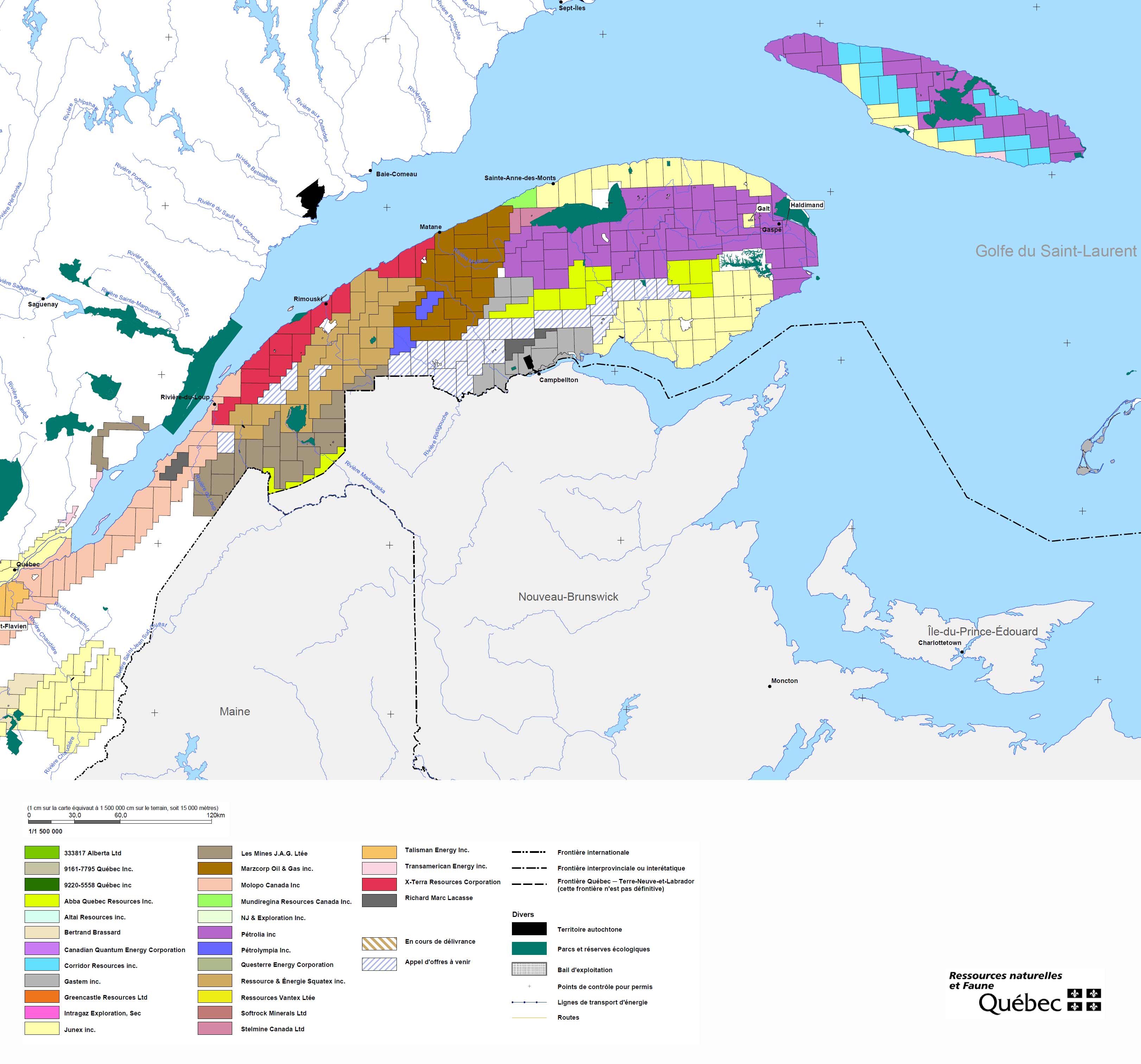
Segment of a 2010 Government of Quebec map showing deep shale petroleum leases along Saint Lawrence River lowlands, the western zone from about the City of Montreal to Quebec City. Segment of a 2010 Government of Quebec map showing deep shale gas petroleum leases from Quebec City eastward to the Gaspe Peninsula. Copy of a government map presented at the recent public review process on shale gas development in Quebec (submission DB-13). The map is only of the Saint Lawrence Lowlands leases, and includes identification numbers on each shale lease block, the year of each lease, and the names of companies who hold the leases identified by various shades of color. The company holder of a lease may have a partnership agreement with another company, or companies, and leases may be transferred to or acquired by another or other companies at any given time, changes which may not be indicated over time on this, and other maps on this website. The following document is a list of all the shale gas licenses. It provides the name of the company, the number of the permit/license, the date of when the license was let, and the area of the given permit in hectares. This document is an accompanying guide to the above map, Shale Gas Leases in Lower Quebec. |