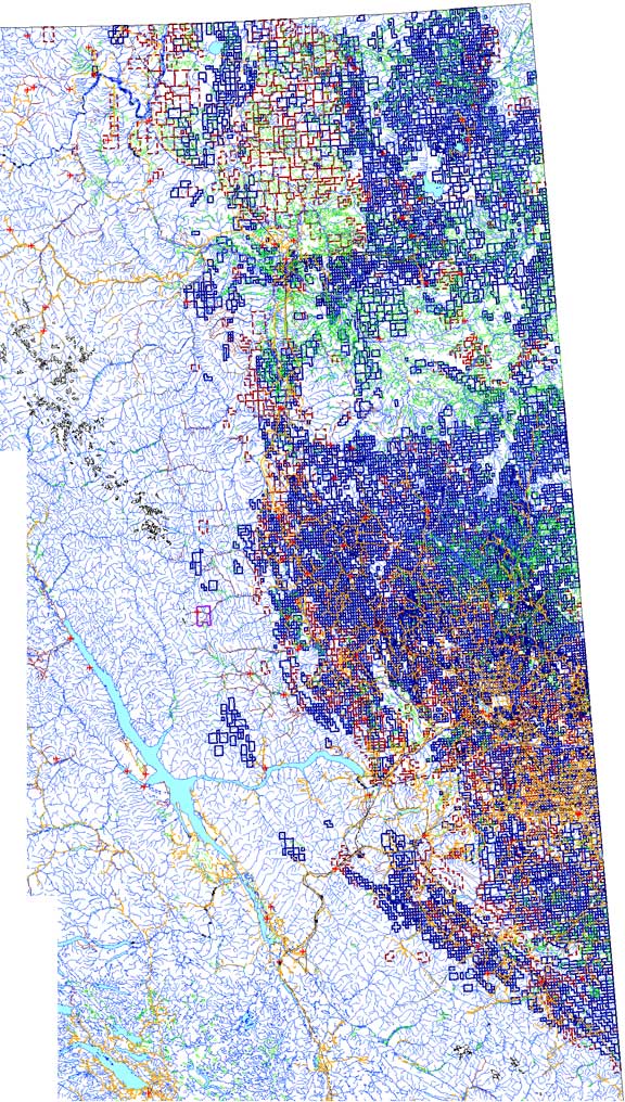
ACTIVE OIL AND GAS TENURE TITLES MAP
NORTHEASTERN BRITISH COLUMBIA
NORTHEASTERN BRITISH COLUMBIA
(Current status of tenures
as of April 5, 2010)
Below is a map of northeastern
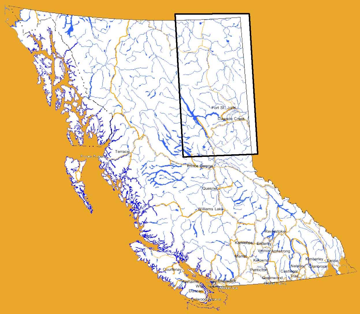 BC showing a vast
area of active oil and gas
tenures. The area is highlighted by a rectangle to scale in a map of BC
to the right (about 400 kilometers in width by 700 kilometers in
length).
BC showing a vast
area of active oil and gas
tenures. The area is highlighted by a rectangle to scale in a map of BC
to the right (about 400 kilometers in width by 700 kilometers in
length). These tenures now cover a land mass of almost ten percent (10%) of British Columbia's 95 million hectares.
The upper portion (yellowish area) is the Horn River Basin area where much of the new gas speculation, development, and hydro-fracking interest is taking place.